In January 2014, the Honduran Institute of Forest Conservation (ICF) classified Tela Bay as a “site of importance for wildlife.” The reef that motivated this classification is called Banco Capiro, off the northern coast of mainland Honduras.
The previous version of this page mixed everything up. It placed Mary’s Place (which is located in Roatán) in Tela, mentioned whale sharks from February to April and manta rays, without a single date or source. We have redone everything.
Here is what can be stated about Tela in 2026, what remains unclear, and the questions to ask before booking.
Where are the reefs of Tela Bay located?
Tela Bay borders the Caribbean coast of mainland Honduras, in the Atlántida department. Its most documented reef, Banco Capiro, is a coral bank off the city. Tela does not belong to the Bay Islands (Roatán, Utila, Guanaja), which are another department and have different logistics.
This confusion appears on many pages, including our old one.
The Bay Islands have relied on diving tourism for decades, with an offer of centers, boats, and marked sites that you can find in our article on diving in Roatán and the Bay Islands. Tela, on the other hand, remains a seaside town on the coast. Its reefs have only been described by scientists since 2011, and the local diving offer seems much more discreet than on the islands. Yet, this is what makes the reef interesting.
Geographically, remember two areas. Offshore, Banco Capiro. Further west, the Jeannette Kawas National Park, often called Punta Sal, which protects mangroves, lagoons, and coastal reefs. The two are not necessarily dived with the same operator, nor under the same sea conditions. Always check which one is being referred to.
What is really known about the Banco Capiro reef?
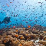
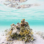
Solid figures come from surveys conducted from 2011 by the Coral Reef Alliance and the Healthy Reefs Initiative. According to ICRI (2014), Banco Capiro has nearly four times more live coral than most reefs in the region, where the average coverage is around 18%.
The same report counts nearly 800 colonies of elkhorn coral (Acropora palmata) in the bay. The species is classified as critically endangered on the IUCN Red List. Teams measured an unusual density of long-spined diadema sea urchins, an algae grazer that has collapsed almost everywhere in the Caribbean. But these measurements date from 2011 to 2014. Nothing indicates they describe the reef today.
In February 2016, Melanie McField, director of the Healthy Reefs Initiative, mentioned on the NOAA Coral-List discussion list more than 65% live coral at Banco Capiro, despite the proximity of river inputs.
The figure of “more than 68%” from the old page had no source. We keep the order of magnitude, dated. And we remove black corals, whale sharks, and manta rays, which no source on Tela confirms. Bleaching remains a threat to all Caribbean reefs, including Banco Capiro (we discuss this in our file on coral bleaching).
What level and conditions should be expected in Tela?
Impossible to decide here. No official source consulted in October 2026 publishes depth, current, or average visibility for Banco Capiro. The required level depends on the chosen site, the sea conditions of the day, the supervision, and your recent practice, so ask the center, site by site, before paying.
A bay receiving rivers can change its appearance after heavy rains. Thus, turbid water and swell count as much as depth, sometimes more when the dive is far from the coast. Good visibility does not make a dive safer. The boat trip to the bank, entry, and ascent without fixed reference weigh more for a beginner. If the center offers a night dive, the question of lighting becomes concrete (see our guide to choosing a dive light).
The current decides more than the photo.
Regarding the season, NOAA sets the official Atlantic hurricane season from June 1 to November 30. The old page announced “February to June” as the best period, without source. We do not repeat it. Rather ask these questions at the center: expected maximum depth, duration of the trip, usual current over the bank, presence of oxygen on board, nearest hyperbaric chamber, and fallback plan if the sea is rough.
What can you do in Jeannette Kawas National Park?
Jeannette Kawas National Park has been listed on the Ramsar list of wetlands of international importance since March 28, 1995. It covers mangroves, coastal lagoons, and coral reefs, between the departments of Atlántida and Cortés. In 2021, Honduras increased its area from 78,150 to 79,382 hectares.
The Ramsar sheet cites several threatened species present on the site, including the Nassau grouper, Acropora corals, the Antillean manatee, the American crocodile, and the leatherback turtle. However, presence does not mean encounter. No outing can promise you a manatee. The same sheet lists threats: deforestation, erosion, pollution by waste and chemicals. The Honduran press has repeatedly documented the advance of oil palm plantations on the park’s edge.
For a diver, Punta Sal is mainly experienced as a day trip.
The offers you will see online often combine boat, beach, and snorkeling. Check who supervises, if the excursion really includes scuba diving, and which park rules apply that day. And apply the right habits, detailed in our article on the rules of respectful diving of marine life, especially near seagrass beds and shallow corals.
Tela or Roatán, how to choose?
If you are looking for a wide diving offer, many centers, and sites described in detail, Roatán fits better. If you want to see a reef known for its coral cover and accept less polished logistics, Tela holds its own. In both cases, ask for written and dated conditions.
In Tela, in October 2026, no center was found whose official site precisely describes its outings on Banco Capiro. A 2013 article from the Coral Reef Alliance cited a local operator and the installation of mooring buoys, but this information is twelve years old. This silence does not prove the absence of offer. It only requires asking more questions. We advise you to book the dive on site or after written exchange, rather than online on a platform that copies generic descriptions.
In short, Tela requires more preparation.
If you compare with other Caribbean reefs, such as those of Cozumel in Mexico, keep the same checklist: level, current, season, supervision, fallback plan. Yet the actual cost of a stay in Tela depends on one margin. Plan one or two buffer days if the sea closes the outing, and a fallback budget to reach the Bay Islands if no center answers you clearly. Would you book it that way?
FAQ
Is Tela Bay part of Roatán?
No. Tela is a city on the northern coast of continental Honduras, in the department of Atlántida. Roatán belongs to the Bay Islands, further north, with their own centers and sites.
Can you see whale sharks in Tela?
No consulted source documents regular observations in Tela. Known seasonal observations in Honduras mainly concern Utila. No outing can guarantee an encounter.
What is the coral cover of Banco Capiro?
The ICRI (2014) speaks of nearly four times more live coral than most reefs in the region, where the average is around 18%. In 2016, the Healthy Reefs Initiative mentioned more than 65%. These figures are dated and do not necessarily describe the current state.
When to dive in Tela Bay?
No official source sets a best period. The Atlantic hurricane season runs from June 1 to November 30 according to NOAA. Ask the center for its conditions in previous years at the same date.
Sources
- Unique Coral Reef Receives Federal Protection in Honduras (International Coral Reef Initiative, 2014)
- Parque Nacional Jeanette Kawas (Ramsar Convention, site sheet 722, updated 2021)
{“@context”:”https://schema.org”,”@type”:”FAQPage”,”mainEntity”:[{“@type”:”Question”,”name”:”La baie de Tela fait-elle partie de Roatán ?”,”acceptedAnswer”:{“@type”:”Answer”,”text”:”Non. Tela est une ville de la côte nord du Honduras continental, dans le département d’Atlántida. Roatán appartient aux îles de la Baie, plus au nord, avec leurs propres centres et sites.”}},{“@type”:”Question”,”name”:”Peut-on voir des requins-baleines à Tela ?”,”acceptedAnswer”:{“@type”:”Answer”,”text”:”Aucune source consultée ne documente d’observations régulières à Tela. Les observations saisonnières connues au Honduras concernent surtout Utila. Aucune sortie ne peut garantir une rencontre.”}},{“@type”:”Question”,”name”:”Quelle est la couverture corallienne de Banco Capiro ?”,”acceptedAnswer”:{“@type”:”Answer”,”text”:”L’ICRI (2014) parle de près de quatre fois plus de corail vivant que la plupart des récifs de la région, où la moyenne tourne autour de 18 %. En 2016, la Healthy Reefs Initiative évoquait plus de 65 %. Ces chiffres datent et ne décrivent pas forcément l’état actuel.”}},{“@type”:”Question”,”name”:”Quand plonger dans la baie de Tela ?”,”acceptedAnswer”:{“@type”:”Answer”,”text”:”Aucune source officielle ne fixe de meilleure période. La saison des ouragans de l’Atlantique court du 1er juin au 30 novembre selon la NOAA. Demande au centre ses conditions des années précédentes à la même date.”}}]}