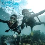
In 2008, UNESCO inscribed the lagoons of New Caledonia as a World Heritage site, in the form of six marine areas. The Isle of Pines, Kunié to its inhabitants, is part of one of them, the Great South Lagoon, about a hundred kilometers southeast of Nouméa.
Our previous page promised a dive “accessible to all levels,” mentioned three clubs, and placed sites on the island that are actually located elsewhere. We have completely revised it.
Here you will find the sites that can truly be associated with the island, a grid for level, current, season, supervision, and fallback plan, then the rules that apply in this lagoon. Conditions without date or source have been removed.
Where do you dive around the Isle of Pines?
On the Isle of Pines, scuba diving is offered by a single center, Kunie Scuba Center, located at the Kodjeue relay, in Ouaméo Bay. Its website states it is the only one on the island. The New Caledonia Tourism sheet assigns it sixteen sites in Gadji Bay, plus the Third Cave.
The three other clubs from our previous version have therefore been removed.
The same sheet describes Gadji Bay with pygmy seahorses, nudibranchs, and leopard sharks. These species are cited by the office, without any guarantee of seeing them. It specifies that Kunie Scuba Center is the only center authorized to dive in the bay. But the Third Cave belongs to another category of diving. It is a freshwater cavity near the Kéré tribe, with stalactites and stalagmites, which the office reserves for experienced divers in good physical condition, minimum level 2 and more than 50 dives. Access is via a long narrow forest track.
Our previous page also placed the Prony Needle in the island’s setting, whereas this site is located in Prony Bay, on the Grande Terre. For the “Daa Kougnié station,” the “Deverd fault,” and the “False Pass of Green Island,” we found no reliable description placing them at the Isle of Pines, so we removed them.
What level and current to expect at the Isle of Pines?
No page can say from a distance if a site suits you. Kunie Scuba Center indicates it chooses its sites according to the day’s weather and each diver’s level, and it highlights drift diving. This last detail is significant, as drift implies current, boat recovery, and a precise briefing.
| Site | Level | Current | Season | Supervision | Fallback Plan |
|---|---|---|---|---|---|
| Gadji Bay | no public level per site, to be requested in writing | impossible to determine from here | recent data to be requested from the center | only authorized center in the bay (New Caledonia Tourism) | another site in the bay according to briefing |
| Third Cave | minimum level 2 and more than 50 dives (New Caledonia Tourism) | undocumented, access and weather weigh more | difficult diving in wet weather according to the office | diving organized by Kunie Scuba Center | postpone if the track is waterlogged |
| Drift dives | to be validated with the center | present by definition, variable strength | impossible to determine from here | boat recovery, safety sausage required | sheltered site chosen at briefing |
The current decides more than the photo.
For what level? The answer depends on the site of the day, and the center announces it itself. Request in writing the required level for each type of dive, the number of divers per guide, and how the boat follows a drift. Verify that your insurance covers diving in New Caledonia. A recently certified diver is not automatically excluded, since the center adapts the site to the level, and the decision is made on site.
And the cave remains a special case. Its diving is done in freshwater, inside a closed cavity, where the level requested by the office serves as a first filter and where the center’s briefing sets the rest.
If you compare with another Pacific lagoon, our guide to diving in Rarotonga, Cook Islands applies the same grid.
Which season to choose for diving at the Isle of Pines?
Impossible to decide from here with reliable figures. Our previous page announced “optimal” visibility and “maximum” biodiversity from May to November, without source or date. We have removed these promises. The solid data concerns cyclones, which affect the archipelago during the austral summer.
Météo-France New Caledonia presents the archipelago as a “hot spot” of cyclone activity in the South Pacific, and counts its cyclone seasons spanning two years, such as 2023-2024. A canceled dive due to wind is part of the game. So plan some buffer days if you are coming from afar. The office’s sheet also reminds that the cave of the Third becomes difficult in wet weather, as the access track suffers from rain. For water temperature and visibility, ask the center for a report from the week preceding your arrival.
Clear water says nothing about the current or the dive.
However, the season also changes what you might encounter. Ifremer describes the Grand South Lagoon as the main breeding area for humpback whales in New Caledonia, without guaranteeing an observation during your dive. Warm water episodes, meanwhile, weigh on the corals, as explained in our article on coral bleaching.
Is the Isle of Pines lagoon listed by UNESCO?
Yes. The property “Lagoons of New Caledonia: reef diversity and associated ecosystems” has been listed as a World Heritage site since 2008 and includes six marine complexes. The Isle of Pines falls under the Grand South Lagoon, which Ifremer describes as a transition zone between subtropical and temperate populations.
The UNESCO sheet provides figures for the entire property. It counts 510 coral species and 1,695 fish species, and notes the third largest population of dugongs worldwide. These figures apply to the entire archipelago, not just the Gadji Bay alone.
Ifremer attributes the highest fish biomass in the territory to the Grand South Lagoon, as well as three species of sea turtles and five marine mammals. It cites a green turtle nesting site and a habitat of the great white shark, an endangered species, which we present in our dossier on the great white shark. A small catshark, Aulohalaelurus kanakorum, is known nowhere else. None of this can be ordered for a dive.
Listing is not everything.
Thus, UNESCO provides management plans for each complex and co-management with the Kanak communities. On the Isle of Pines, a local management committee received in February 2014 the report of the first five years of listing presented by the Southern Province (Les Nouvelles Calédoniennes, February 13, 2014). However, the Coral Sea Natural Park, often cited in brochures, does not cover this lagoon. Created by decree of the New Caledonia government on April 23, 2014, over 1,291,970 km², it excludes internal and territorial waters under the jurisdiction of the provinces, according to its official brochure. The distinction matters for knowing who sets the rules.
What rules must be respected in the protected areas of the Southern Province?
The Isle of Pines lagoon depends on the Southern Province, which publishes a sheet on proper behavior in its protected areas. It asks to observe turtles at 10 m without following them. Birds are to be watched at 40 m, and the sheet prohibits feeding animals, collecting corals or shells, walking on corals, and using drones.
The same sheet mentions a fishing ban. It does not specify fines, distances for dugongs or whales, nor anchoring rules. For these points, the dive center and the island’s town hall remain your contacts. Ifremer also notes a fully protected marine reserve, the Yves Merlet reserve, in the eastern part of the Grand South Lagoon. If a program mentions this sector, ask what its status allows.
Yet, the rule that matters most is about your buoyancy control.
A misplaced fin breaks coral in a second, and a drift pushes you toward the reef without warning, especially when you are still adjusting your buoyancy compensator. We detailed why you should never touch marine life, including cases where contact also injures the diver. Regarding sunscreen, our comparison on non-toxic sunscreen for corals helps you choose without relying on commercial claims.
In short, the Isle of Pines offers diving with a single center, a reserved bay, and currents whose strength cannot be predicted in advance. The price is paid in flexibility: extra days for weather, a level to be confirmed before departure, and a cave dive that already requires experience. Would you book it this way?
FAQ
How many diving centers are there on the Isle of Pines?
Kunie Scuba Center presents itself on its official website as the only diving center on the island (accessed October 3, 2026). It is located at the Kodjeue relay, in Ouaméo Bay. New Caledonia Tourism describes it as the only center authorized to dive in Gadji Bay.
What level is required to dive in the Troisième cave?
New Caledonia Tourism reserves it for experienced divers in good physical condition, with a minimum level 2 and more than 50 dives. It is a freshwater cave, accessible via a forest trail. Diving becomes difficult there in wet weather.
Is the Isle of Pines part of the Coral Sea Natural Park?
No. According to its official brochure, the park created on April 23, 2014 excludes internal and territorial waters under the jurisdiction of the provinces. The lagoon of the Isle of Pines falls under the Southern Province and the UNESCO World Heritage site inscribed in 2008.
At what distance should you observe a turtle on the Isle of Pines?
In its protected areas, the Southern Province requests observing turtles at 10 m and not following them. The same leaflet prohibits feeding animals and collecting corals or shells. Your guide can specify the site’s instructions during the briefing.
Sources
- New Caledonia Lagoons: Reef Diversity and Associated Ecosystems (UNESCO, World Heritage Centre, inscription 2008)
- Protected Areas of the Southern Province: Good Practices to Adopt (Southern Province, New Caledonia, accessed October 3, 2026)
{“@context”:”https://schema.org”,”@type”:”FAQPage”,”mainEntity”:[{“@type”:”Question”,”name”:”Combien y a-t-il de centres de plongée à l’île des Pins ?”,”acceptedAnswer”:{“@type”:”Answer”,”text”:”Kunie Scuba Center se présente sur son site officiel comme le seul centre de plongée de l’île (consulté le 3 octobre 2026). Il est installé au relais de Kodjeue, en baie de Ouaméo. Nouvelle-Calédonie Tourisme le décrit comme le seul centre autorisé à plonger en baie de Gadji.”}},{“@type”:”Question”,”name”:”Quel niveau faut-il pour plonger dans la grotte de la Troisième ?”,”acceptedAnswer”:{“@type”:”Answer”,”text”:”Nouvelle-Calédonie Tourisme la réserve aux plongeurs expérimentés en bonne condition physique, avec un niveau 2 minimum et plus de 50 plongées. C’est une grotte d’eau douce, accessible par une piste forestière. La plongée y devient difficile par temps humide.”}},{“@type”:”Question”,”name”:”L’île des Pins fait-elle partie du Parc naturel de la mer de Corail ?”,”acceptedAnswer”:{“@type”:”Answer”,”text”:”Non. Selon sa plaquette officielle, le parc créé le 23 avril 2014 exclut les eaux intérieures et territoriales placées sous la compétence des provinces. Le lagon de l’île des Pins relève de la province Sud et du bien UNESCO inscrit en 2008.”}},{“@type”:”Question”,”name”:”À quelle distance observer une tortue à l’île des Pins ?”,”acceptedAnswer”:{“@type”:”Answer”,”text”:”Dans ses aires protégées, la province Sud demande d’observer les tortues à 10 m et de ne pas les suivre. La même fiche interdit de nourrir les animaux et de ramasser coraux ou coquillages. Ton guide peut préciser les consignes du site au briefing.”}}]}