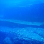
On September 2, 1968, off North Bimini, in the Bahamas, divers spotted a line of large limestone blocks lying at a depth of 5 to 7 meters. It stretches for about 800 meters. Within a few months, the “Bimini Road” became for part of the press proof that Atlantis had existed.
Yet the source of the myth lies in two dialogues by Plato, written around 360 BCE. Between them, there are twenty-three centuries of readings and hypotheses.
Our old page mixed everything up: ancient texts, poorly dated satellite images, and travel advice to an Andalusian marsh. We have revisited the topic starting from the texts, with geology and archaeology in mind.
What does Plato really say about Atlantis?
Plato describes Atlantis in the Timaeus and Critias. According to his account, it was an island larger than Libya and Asia combined, located beyond the Pillars of Hercules. Nine thousand years before Solon, it supposedly attacked Athens, lost the war, then disappeared into the sea in a single day and night.
The story passes through several mouths. Critias would have received it from his grandfather, who got it from Solon, who learned it from Egyptian priests at Sais. This cascading relay gives the text an archival feel. Plato liked this method. No earlier Greek text mentions Atlantis, and the entire debate starts there.
Critias adds the details that have inspired generations of readers, with Poseidon uniting with a mortal, Clito, and Atlas, the eldest of their five pairs of twins, becoming the first king of the island.
The capital is surrounded by alternating rings, two of land and three of sea. Its walls are plated with bronze, tin, and orichalcum. But the dialogue breaks off mid-sentence, just as Zeus has gathered the gods to punish the Atlanteans. The text ends there. Many historians of philosophy read it as a political fable (the counter-model to the ideal Athens Plato describes just before).
Did the Santorini eruption inspire the myth?
This is the most serious lead, and it remains a hypothesis. Around 1600 BCE, the Minoan eruption emptied Santorini (ancient Thera) of its inhabitants and formed the current caldera, according to the Smithsonian Institution’s Global Volcanism Program. Dating published in 2006: between 1627 and 1600 BCE.
At Akrotiri, on the south of the island, violent earthquakes forced inhabitants to leave before the main eruption. The city was then buried under thick deposits of ash and pumice, then covered by pyroclastic flows that preserved its streets and houses. Excavations started in 1967 by archaeologist Spyridon Marinatos uncovered a very well-preserved Bronze Age city. The connection to a disaster story is tempting. It is understandable why it has captivated people.
Yet, the details do not match.
Plato places the island beyond the Pillars of Hercules, thus outside the Mediterranean, and dates its disappearance to nine thousand years before Solon. Supporters of the Santorini theory suppose a tenfold error in the figures transmitted by the Egyptian priests, which would bring the date and size closer to the Greek island. Impossible to decide from here. The eruption is a dated fact; its link to Plato remains an interpretation.
And if you visit Santorini, Akrotiri can be visited on land, under the large roof protecting the excavations.
Is the Bimini Road a remnant of Atlantis?
No, according to the geologists who studied it. Eugene Shinn, from the US Geological Survey, and Peter Swart, from the University of Miami, see it as beachrock, a naturally cemented beach sandstone. The blocks, lying between 5 and 7 meters deep, show the same layered structure as deposits on current beaches.
The story had all the ingredients to please. In the 1940s, medium Edgar Cayce had predicted a reappearance of Atlantis in 1968 or 1969. And the line of blocks was spotted in September 1968. The slabs are roughly rectangular and measure several meters on each side, so that, seen from the surface, the alignment looks like paving laid by human hands.
Shinn took core samples from the blocks in 1977, then had them radiocarbon dated the following year. The ages obtained range around 2,800 to 3,500 years. Their shape comes from natural fracturing. A thin slab lying on loose sand breaks like ice on a pond, into right-angled pieces that mimic human work when viewed from the surface. The analysis was published in the journal Nature in 1980.
In short, the Bimini Road tells a real story, that of an ancient shoreline drowned by rising sea levels.
Doñana, Azores, Yonaguni: how valid are the other leads?
None has provided archaeological evidence of a city matching Plato’s account. Some are based on satellite images, others on rock formations or map interpretations. The table below summarizes, lead by lead, what is observed and what remains only assumed.
| Lead | What is observed | Current status |
|---|---|---|
| Santorini (Greece) | Eruption dated around 1600 BCE, buried city of Akrotiri | Hypothesis of inspiration, no proof of a link to Plato |
| Bimini (Bahamas) | Beachrock blocks between 5 and 7 m deep | Natural formation according to geological studies |
| Doñana (Spain) | Geometric shapes on satellite images (2004), surveys in 2011 | Contested interpretation, marsh located inland |
| Azores (Atlantic) | Volcanic islands on the Mid-Atlantic Ridge | No sunken continent identified |
| Yonaguni (Japan) | Sandstone terraces spotted in 1986 | Natural fracturing according to many geologists |
In 2004, German physicist Rainer Kühne reported, on satellite images of the Hinojos marsh in Doñana National Park, two rectangular structures surrounded by circles. In 2011, a team led by archaeologist Richard Freund from the University of Hartford, USA, conducted radar and electrical resistivity surveys there, later presented in a TV documentary. Spanish researchers working in the area since 2005 disputed these conclusions. Our old page dated the images to 2011 and even recommended visiting the site as if there was something to see. However, Doñana is a protected marsh with nothing to dive.
A shape does not date anything.
For the Azores, geology closes the door. The archipelago consists of volcanic islands born on the Mid-Atlantic Ridge, where the ocean floor forms, and no collapsed continent has been identified there. As for Yonaguni, we detailed it in our feature on Lemuria and Mu, the lost continents of the Pacific. Its sandstone terraces are described there as rock fractured along regular planes.
Which sunken cities can you really dive?
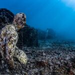
Few, and rarely those associated with Atlantis. The Bimini road, between 5 and 7 meters deep, is offered as an outing from the island. In Italy, the Baia underwater park welcomes guided dives by authorized centers. Pavlopetri, in Greece, can be explored with mask and snorkel.
Two famous sites remain closed. Port Royal, Jamaica, is only accessible for research authorized by the Jamaica National Heritage Trust, as detailed in our article on the sunken ruins of Port Royal. Thonis-Heracleion, Egypt, is an excavation site, and our feature on the spectacular rediscovery of Heracleion explains why tourists do not go there. For an overview, we have ranked the sunken cities you can actually dive with their legal framework. For Roman ruins, check out the sunken Roman city of Baia.
Five meters depth tells nothing about the current.
However, at Bimini as elsewhere, no official and dated data on the current or swell of the site has been found. Before booking, ask the operator for the exact depth, usual current, required level, planned supervision, and backup dive if the sea rises. If you combine with other islands, our guide to diving in the Bahamas and the Exumas provides other references. The real price of an “Atlantis” outing? Half a day by boat and one dive to see an ancient shore. It’s worth the detour, provided you know before boarding that you are going to see geology.
FAQ
Did Atlantis really exist?
No archaeological evidence supports it. The only ancient testimony is Plato’s account, in Timaeus and Critias, written around 360 BCE. Many historians see it as a political fable.
Where was Atlantis according to Plato?
Beyond the Pillars of Hercules, that is to say after the Strait of Gibraltar, in the ocean. Plato describes it as an island larger than Libya and Asia combined, submerged nine thousand years before Solon.
What is the connection between Santorini and Atlantis?
The Minoan eruption of Santorini, dated around 1600 BCE, devastated the island and buried the city of Akrotiri. Some researchers see it as the inspiration for the myth. However, the location and date given by Plato do not match.
Is the Bimini Road natural?
Yes, according to geological studies conducted by the USGS and the University of Miami. The blocks are beachrock, a beach sandstone cemented and then naturally fractured into slabs. Radiocarbon dating gives ages on the order of 2,800 to 3,500 years.
Can you dive on ruins linked to Atlantis?
No ruins are proven to be linked to Atlantis. The shallow Bimini Road is offered as a dive site from the island. Port Royal and Heracleion remain closed to recreational diving, while Baia welcomes guided dives.
Sources
- Global Volcanism Program | Santorini (Smithsonian Institution, accessed October 3, 2026)
- The mystic of beachrock (E. A. Shinn, USGS, and P. K. Swart, University of Miami, Geological Society of America, 2005)
{“@context”:”https://schema.org”,”@type”:”FAQPage”,”mainEntity”:[{“@type”:”Question”,”name”:”L’Atlantide a-t-elle vraiment existé ?”,”acceptedAnswer”:{“@type”:”Answer”,”text”:”Aucune preuve archéologique ne l’atteste. Le seul témoignage ancien est le récit de Platon, dans le Timée et le Critias, écrits vers 360 avant notre ère. Beaucoup d’historiens y voient une fable politique.”}},{“@type”:”Question”,”name”:”Où se trouvait l’Atlantide selon Platon ?”,”acceptedAnswer”:{“@type”:”Answer”,”text”:”Au-delà des Colonnes d’Héraclès, c’est-à-dire après le détroit de Gibraltar, dans l’océan. Platon la décrit comme une île plus grande que la Libye et l’Asie réunies, engloutie neuf mille ans avant Solon.”}},{“@type”:”Question”,”name”:”Quel lien entre Santorin et l’Atlantide ?”,”acceptedAnswer”:{“@type”:”Answer”,”text”:”L’éruption minoenne de Santorin, datée vers 1600 avant notre ère, a ravagé l’île et enseveli la ville d’Akrotiri. Certains chercheurs y voient l’inspiration du mythe. La localisation et la date données par Platon ne correspondent pourtant pas.”}},{“@type”:”Question”,”name”:”La route de Bimini est-elle naturelle ?”,”acceptedAnswer”:{“@type”:”Answer”,”text”:”Oui, selon les études géologiques menées par l’USGS et l’université de Miami. Les blocs sont du beachrock, un grès de plage cimenté puis fracturé naturellement en dalles. Les datations au radiocarbone donnent des âges de l’ordre de 2 800 à 3 500 ans.”}},{“@type”:”Question”,”name”:”Peut-on plonger sur des ruines liées à l’Atlantide ?”,”acceptedAnswer”:{“@type”:”Answer”,”text”:”Aucune ruine n’est liée de façon prouvée à l’Atlantide. La route de Bimini, peu profonde, est proposée en sortie depuis l’île. Port Royal et Héracléion restent fermés à la plongée de loisir, alors que Baia accueille des plongées guidées.”}}]}